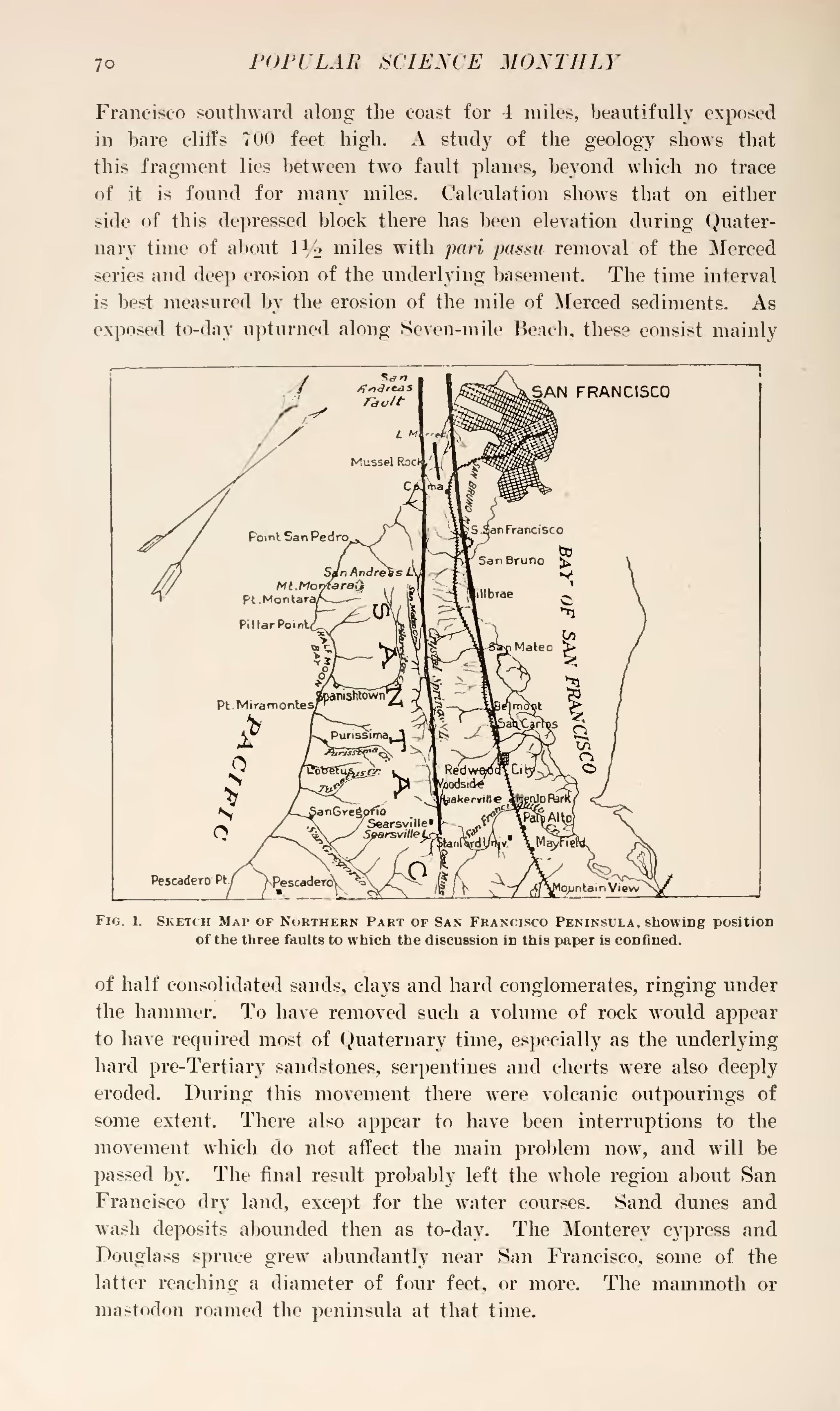
Francisco southward along the coast for-i miles, beautifully exposed in bare cliffs 700 feet high. A study of the geology shows that this fragment lies between two fault planes, beyond which no trace of it is found for many miles. Calculation shows that on either side of this depressed block there has been elevation during Quaternary time of about 11⁄2 miles with pari passu removal of the Merced series and deep erosion of the underlying basement. The time interval is best measured by the erosion of the mile of Merced sediments. As exposed to-day upturned along Seven-mile Beach, these consist mainly

of half consolidated sands, clays and hard conglomerates, ringing under the hammer. To have removed such a volume of rock would appear to have required most of Quaternary time, especially as the underlying hard pre-Tertiary sandstones, serpentines and cherts were also deeply eroded. During this movement there were volcanic outpourings of some extent. There also appear to have been interruptions to the movement which do not affect the main problem now, and will be passed by. The final result probably left the whole region about San Francisco dry land, except for the water courses. Sand dunes and wash deposits abounded then as to-day. The Monterey cypress and Douglass spruce grew abundantly near San Francisco, some of the latter reaching a diameter of four feet, or more. The mammoth or mastodon roamed the peninsula at that time.
