This page has been validated.
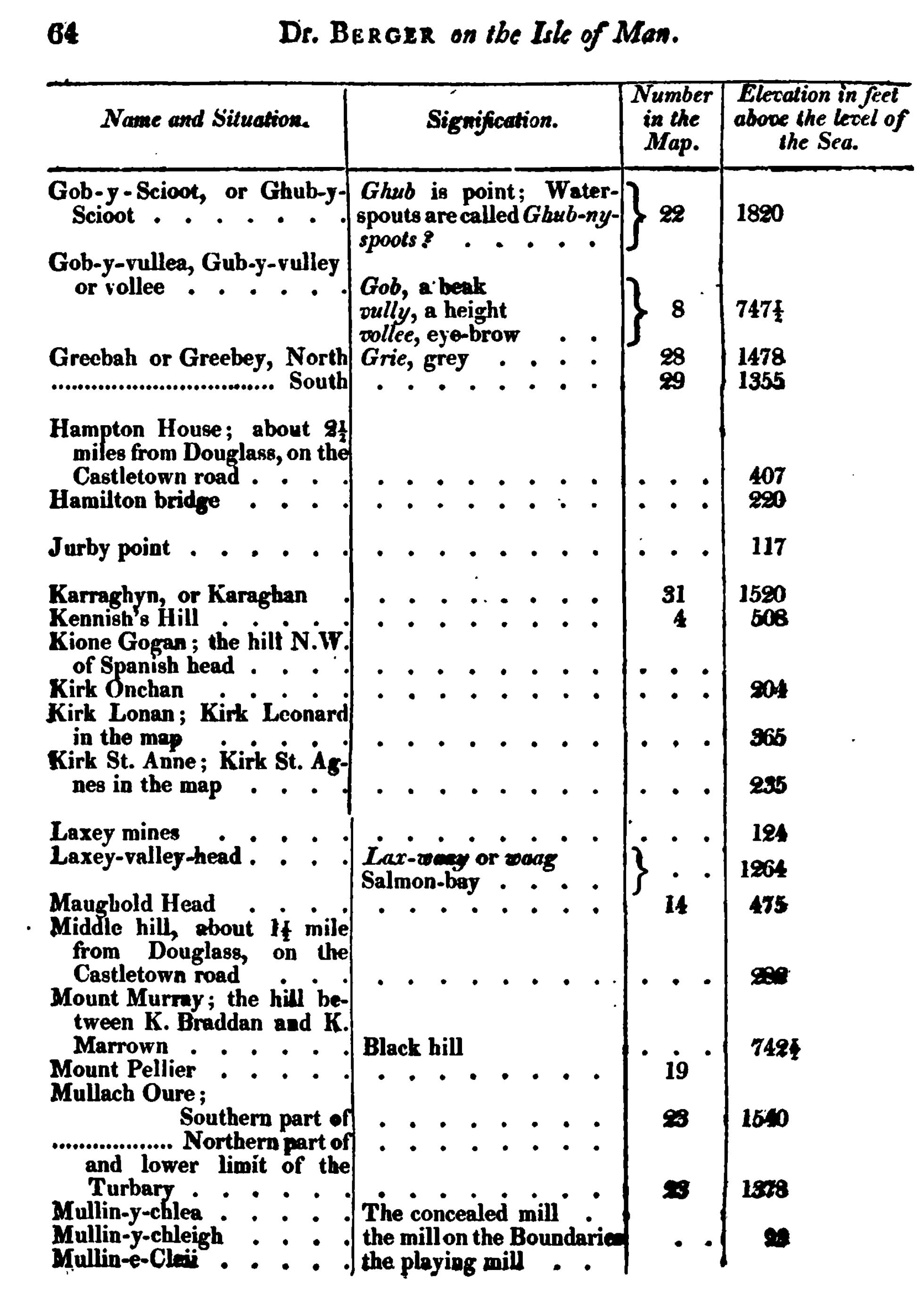
64
Dr. Berger on the Isle of Man
| Names and Situation. | Signification. | Number in the Map. |
Elevation in feet above the level of the sea. |
| Gob-y-Scioot, or Gub-y-Scioot | Ghub is point, Water-spouts are called Ghub-ny-spoots? | 22 | 1820 |
| Gob-y-vullea, Gub-y-vulley or vollee | Gob, a beak vully, a height vollee, eye-brow |
8 | 747½ |
| Greebah or Greebey, North | Grie, grey | 28 | 1478 |
| South | 29 | 1355 | |
| Hampton House, about 2½ miles from Douglass, on the Castletown road | 407 | ||
| Hamilton bridge | 220 | ||
| Jurby point | 117 | ||
| Karraghyn, or Karaghan | 31 | 1520 | |
| Kennish's Hill | 4 | 508 | |
| Kione Gogan; the hill N.W. of Spanish head | |||
| Kirk Onchan | 204 | ||
| Kirk Lonan; Kirk Leonard in the map | 365 | ||
| Kirk St. Anne; Kirk St. Agnes in the map | 235 | ||
| Laxey mines | 124 | ||
| Laxey-valley-head | Lax-waay or waag Salmon-bay |
1264 | |
| Maughold Head | 14 | 475 | |
| Middle hill, about 1½ mile from Douglass, on the Castletown road | 282 | ||
| Mount Murray; the hill between K. Braddan and K. Marrown | Black hill | 742½ | |
| Mount Pellier | 19 | ||
| Mullach Oure; Southern part of | 23 | 1540 | |
| ── Northern part of it and lower limit of the Turbary | 23 | 1378 | |
| Mullin-y-chlea | The concealed mill | ||
| Mullin-y-chleigh | the mill on the Boundaries | 28 | |
| Mullin-e-Cleii | the playing mill |