File:Angola map.png
No higher resolution available.
Angola_map.png (326 × 351 pixels, file size: 11 KB, MIME type: image/png)
| This is a file from the Wikimedia Commons. Information from its description page there is shown below. Commons is a freely licensed media file repository. You can help. |
Summary
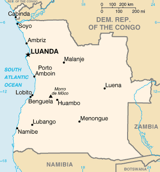
| Description | Angola map from CIA World Factbook, converted from original GIF format |
| Date | |
| Source | CIA World Factbook |
| Author | United States Central Intelligence Agency |
Licensing
This image is in the public domain because it contains materials that originally came from the United States Central Intelligence Agency's World Factbook.
|
 |
File history
Click on a date/time to view the file as it appeared at that time.
| Date/Time | Thumbnail | Dimensions | User | Comment | |
|---|---|---|---|---|---|
| current | 19:05, 30 October 2021 | | 326 × 351 (11 KB) | Auguel | Remove border |
| 12:12, 15 May 2005 |  | 330 × 354 (11 KB) | Nord68 | {{PD-USGov-CIA-WF}} |
File usage
The following page uses this file:
Global file usage
The following other wikis use this file:
- Usage on ar.wikipedia.org
- Usage on arz.wikipedia.org
- Usage on ast.wikipedia.org
- Usage on azb.wikipedia.org
- Usage on az.wikipedia.org
- Usage on ban.wikipedia.org
- Usage on bs.wikipedia.org
- Usage on ca.wikipedia.org
- Luanda
- Frontera entre Angola i la República Democràtica del Congo
- Frontera entre Angola i Zàmbia
- Llista d'aeroports d'Angola
- Llista de ciutats d'Angola
- Resolució 1045 del Consell de Seguretat de les Nacions Unides
- Resolució 1294 del Consell de Seguretat de les Nacions Unides
- Resolució 1348 del Consell de Seguretat de les Nacions Unides
- Llista de governadors colonials d'Angola
- Mòdul:Location map/data/Angola
- Mòdul:Location map/data/Angola/ús
- Usage on ckb.wikipedia.org
- Usage on cy.wikipedia.org
- Usage on dag.wikipedia.org
- Usage on da.wikipedia.org
- Usage on de.wikipedia.org
- Usage on diq.wikipedia.org
- Usage on dsb.wikipedia.org
- Usage on el.wikipedia.org
- Usage on en.wikipedia.org
- List of cities and towns in Angola
- List of colonial governors of Angola
- Talk:Geography of Angola
- United Nations Angola Verification Mission II
- List of airports in Angola
- Outline of Angola
- United Nations Security Council Resolution 1045
- United Nations Security Council Resolution 1294
- United Nations Security Council Resolution 1348
View more global usage of this file.