File:Chart of South America JRGSL Volume I.jpg

Size of this preview: 440 × 599 pixels. Other resolutions: 176 × 240 pixels | 352 × 480 pixels | 564 × 768 pixels | 752 × 1,024 pixels | 1,504 × 2,048 pixels | 4,627 × 6,300 pixels.
Original file (4,627 × 6,300 pixels, file size: 1.69 MB, MIME type: image/jpeg)
| This is a file from the Wikimedia Commons. Information from its description page there is shown below. Commons is a freely licensed media file repository. You can help. |
Summary
| Description |
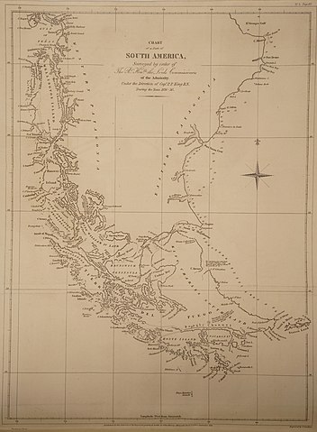
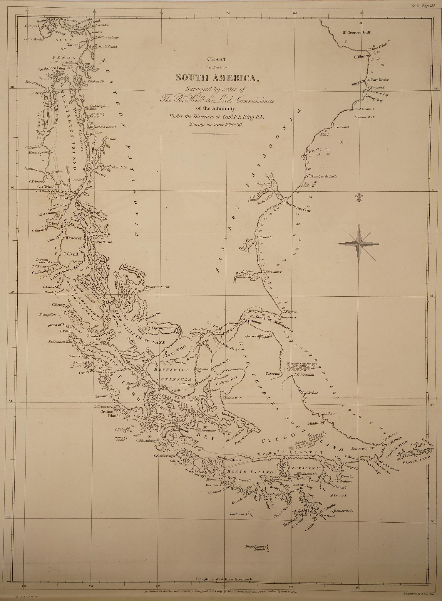
English: Chart to accompany journal article "Some Observations upon the Geography of the Southern Extremity of South America, Tierra del Fuego, and the Strait of Magalhaens" in Volume I, Journal of the Royal Geographical Society of London. Based on voyages done by HMS Adventure and HMS Beagle in 1826-1830 |
| Date | |
| Source | https://archive.org/details/s572id13378760/page/n181/mode/2up |
| Author | Phillip Parker King, James Gardner |
Licensing
|
This work is in the public domain in its country of origin and other countries and areas where the copyright term is the author's life plus 70 years or fewer. This work is in the public domain in the United States because it was published (or registered with the U.S. Copyright Office) before January 1, 1929. | |
| This file has been identified as being free of known restrictions under copyright law, including all related and neighboring rights. | |
File history
Click on a date/time to view the file as it appeared at that time.
| Date/Time | Thumbnail | Dimensions | User | Comment | |
|---|---|---|---|---|---|
| current | 14:34, 1 August 2020 | | 4,627 × 6,300 (1.69 MB) | MarkLSteadman | Uploaded a work by Phillip Parker King from https://archive.org/details/s572id13378760/page/n181/mode/2up with UploadWizard |
File usage
The following 2 pages use this file: