File:EB1911 Europe - 1715.jpg

Size of this preview: 800 × 493 pixels. Other resolutions: 320 × 197 pixels | 640 × 394 pixels | 1,024 × 630 pixels | 1,280 × 788 pixels | 1,751 × 1,078 pixels.
Original file (1,751 × 1,078 pixels, file size: 720 KB, MIME type: image/jpeg)
| This is a file from the Wikimedia Commons. Information from its description page there is shown below. Commons is a freely licensed media file repository. You can help. |
Summary
| Description |
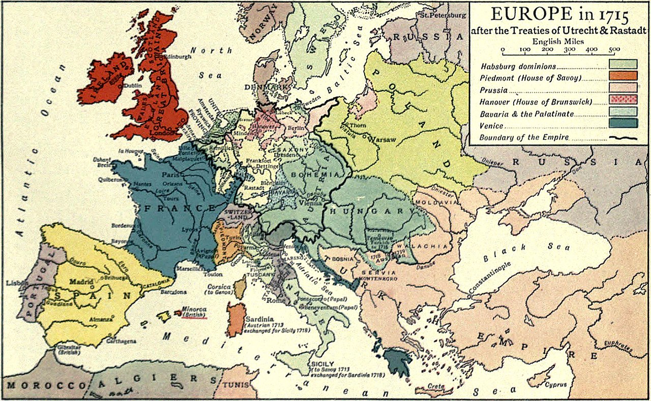
English: Political map of Europe as it appeared in 1715. |
|||
| Date | published 1911 | |||
| Source | “Europe,” Encyclopædia Britannica (11th ed.), v. 9, 1911, facing p. 920 (bottom). | |||
| Author | engraved by Emery Walker | |||
| Permission (Reusing this file) |
|

File history
Click on a date/time to view the file as it appeared at that time.
| Date/Time | Thumbnail | Dimensions | User | Comment | |
|---|---|---|---|---|---|
| current | 17:09, 9 August 2018 | | 1,751 × 1,078 (720 KB) | Bob Burkhardt | {{Information |description ={{en|1=Political map of Europe as it appeared in 1715.}} |date =published 1911 |source =“Europe,” ''Encyclopædia Britannica'' (11th ed.), v. 9, 1911, facing p. 920 (bottom). |author =engraved by Emery Walker |permission ={{PD-Britannica}} }} Category:Old maps showing history of Western Europe |
File usage
The following 2 pages use this file:
Global file usage
The following other wikis use this file:
- Usage on en.wikipedia.org