File:EB1911 Malay Peninsula - map.jpg
Size of this preview: 390 × 599 pixels. Other resolutions: 156 × 240 pixels | 312 × 480 pixels | 500 × 768 pixels | 1,102 × 1,692 pixels.
Original file (1,102 × 1,692 pixels, file size: 577 KB, MIME type: image/jpeg)
| This is a file from the Wikimedia Commons. Information from its description page there is shown below. Commons is a freely licensed media file repository. You can help. |
Summary
| Description |
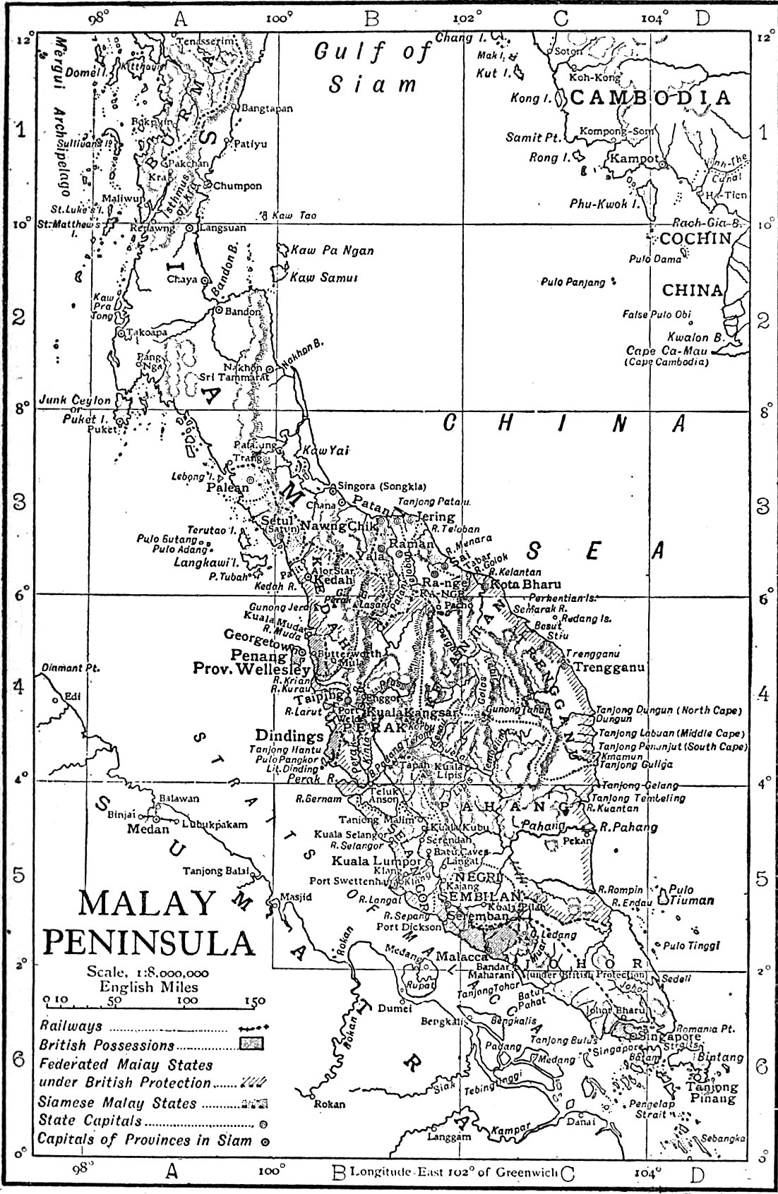
English: Map of the Malay Peninsula. |
|||
| Date | published 1911 | |||
| Source | “Malay Peninsula,” Encyclopædia Britannica (11th ed.), v. 17, 1911, p. 473. | |||
| Author | engraved by Emery Walker | |||
| Permission (Reusing this file) |
|

File history
Click on a date/time to view the file as it appeared at that time.
| Date/Time | Thumbnail | Dimensions | User | Comment | |
|---|---|---|---|---|---|
| current | 22:56, 12 February 2019 | | 1,102 × 1,692 (577 KB) | Library Guy | {{Information |description ={{en|1=Map of the Malay Peninsula.}} |date =published 1911 |source =“Malay Peninsula,” ''Encyclopædia Britannica'' (11th ed.), v. 17, 1911, p. 473. |author =engraved by Emery Walker |permission ={{PD-Britannica}} }} Category:Old maps of Malaysia Category:Old maps of Thailand |
File usage
The following 2 pages use this file: