File:EB9 West Virginia.jpg
Size of this preview: 800 × 588 pixels. Other resolutions: 320 × 235 pixels | 640 × 470 pixels | 1,024 × 752 pixels | 1,280 × 941 pixels | 2,560 × 1,881 pixels | 3,824 × 2,810 pixels.
Original file (3,824 × 2,810 pixels, file size: 2.5 MB, MIME type: image/jpeg)
| This is a file from the Wikimedia Commons. Information from its description page there is shown below. Commons is a freely licensed media file repository. You can help. |
| Description |
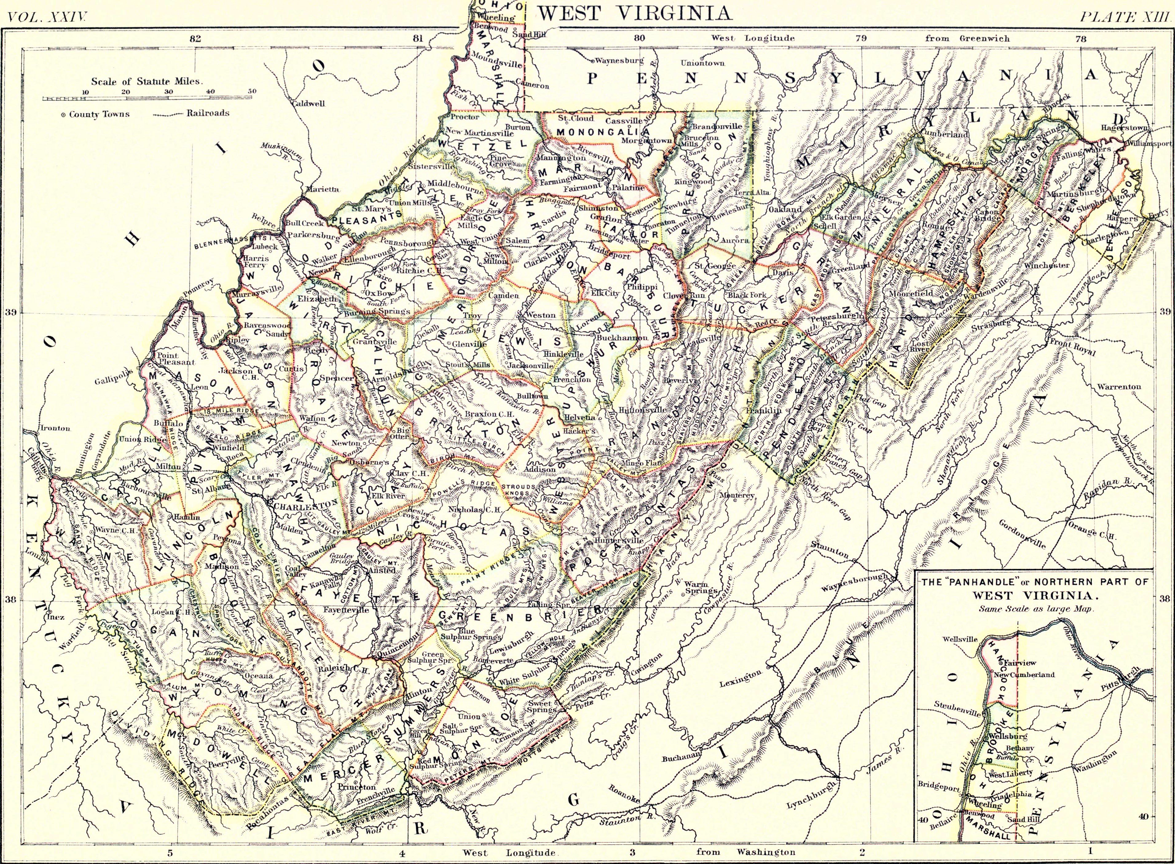
English: Map of West Virginia, showing towns, counties and topography. |
|||
| Date | published 1888 | |||
| Source | Encyclopædia Britannica (9th ed.), v. 24, 1888, facing p. 517. | |||
| Author | W. & A. K. Johnston | |||
| Permission (Reusing this file) |
|

File history
Click on a date/time to view the file as it appeared at that time.
| Date/Time | Thumbnail | Dimensions | User | Comment | |
|---|---|---|---|---|---|
| current | 15:52, 10 July 2013 | | 3,824 × 2,810 (2.5 MB) | Bob Burkhardt | {{Information |Description={{en|Map of West Virginia, showing towns, counties and topography.}} |Source=''Encyclopædia Britannica'' (9th ed.), v. 24, 1888, facing p. 517. |Date=published 1888 |Author=W. & A. K. Johnston |Permission={{PD-Britannica}} |... |
File usage
The following page uses this file: