File:Maps Of Old London Agas London.jpg
Original file (3,717 × 1,601 pixels, file size: 1.44 MB, MIME type: image/jpeg)
| This is a file from the Wikimedia Commons. Information from its description page there is shown below. Commons is a freely licensed media file repository. You can help. |
Summary
| Description |
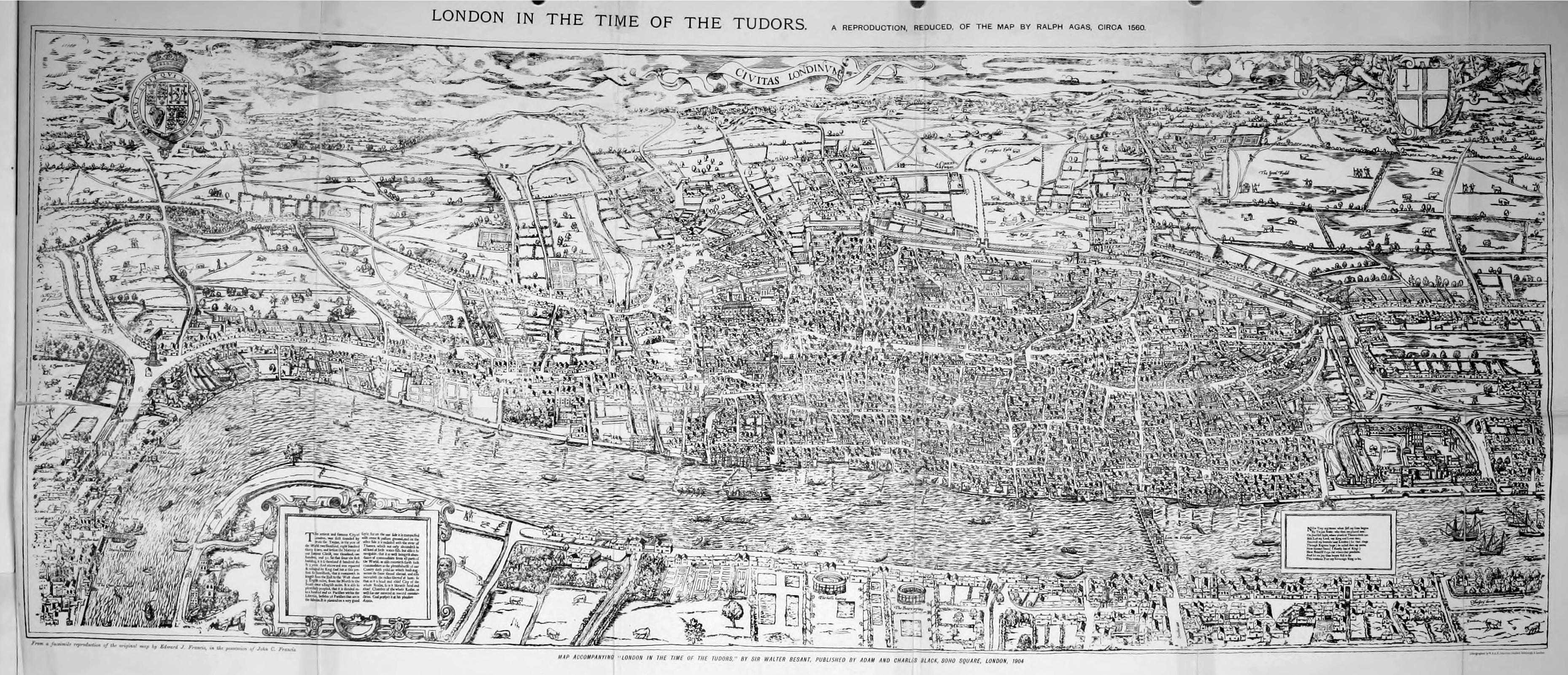
English: Civitas Londinum. |
| Date | circa 1590 |
| Source | Maps of Old London, ed. G. E. (Geraldine Edith) Mitton (1908) |
| Author | Ralph Agas (attrib.) |
Licensing
| This image comes from the Project Gutenberg archives. This is an image that has come from a book or document for which the American copyright has expired and this image is in the public domain in the United States and possibly other countries.
This eBook is for the use of anyone anywhere at no cost and with almost no restrictions whatsoever. You may copy it, give it away or re-use it under the terms of the Project Gutenberg License included with this eBook or online at www.gutenberg.net. |
|
This work is in the public domain in its country of origin and other countries and areas where the copyright term is the author's life plus 100 years or fewer. | |
| This file has been identified as being free of known restrictions under copyright law, including all related and neighboring rights. | |
File history
Click on a date/time to view the file as it appeared at that time.
| Date/Time | Thumbnail | Dimensions | User | Comment | |
|---|---|---|---|---|---|
| current | 22:29, 15 July 2012 | | 3,717 × 1,601 (1.44 MB) | Keith Edkins | == {{int:filedesc}} == {{Information |Description={{en|1=Civitas Londinum.}} |date=ca. 1590 |Source=''Maps of Old London'', ed. G. E. (Geraldine Edith) Mitton (1908) |Author=Ralph Agas (attrib.) |Permission= |other_versions= }} == {{int:license}} == {... |
File usage
The following page uses this file: