File:Plan of Constantinople.PNG
Size of this preview: 427 × 599 pixels. Other resolutions: 171 × 240 pixels | 342 × 480 pixels | 547 × 768 pixels | 1,084 × 1,521 pixels.
Original file (1,084 × 1,521 pixels, file size: 2.94 MB, MIME type: image/png)
| This is a file from the Wikimedia Commons. Information from its description page there is shown below. Commons is a freely licensed media file repository. You can help. |
Summary
| Description |
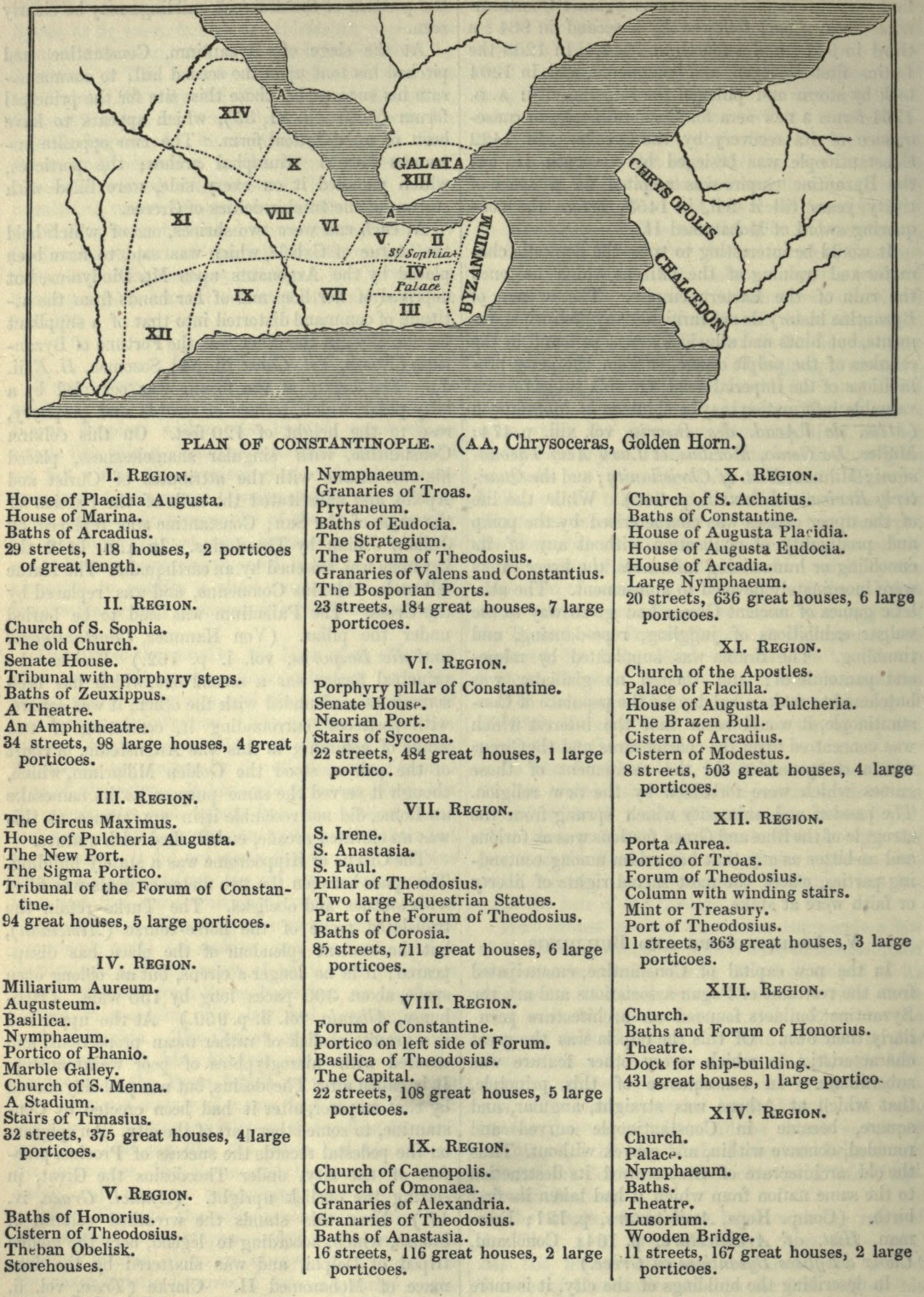
English: Plan of Constantinople with its regions and the major buildings located in each, after the Notitia Urbis Constantinopolitanae of ca. 425 AD.
Nederlands: Plattegrond van Constantinopel. |
| Date | |
| Source | W. Smith, Dictionary of Greek and Roman Geography, 1854, p. 662 |
| Author |
Licensing
|
This work is in the public domain in its country of origin and other countries and areas where the copyright term is the author's life plus 70 years or fewer. | |
| This file has been identified as being free of known restrictions under copyright law, including all related and neighboring rights. | |
File history
Click on a date/time to view the file as it appeared at that time.
| Date/Time | Thumbnail | Dimensions | User | Comment | |
|---|---|---|---|---|---|
| current | 14:15, 16 July 2009 | | 1,084 × 1,521 (2.94 MB) | Evil berry | {{Information |Description={{en|1=Plan of Constantinople.}} {{nl|1=Plattegrond van Constantinopel.}} |Source=W. Smith, ''Dictionary of Greek and Roman Geography'', 1854, p. 662 |Author=- |Date=1854 |Permission= |other_versions= }} [[Category:Constantinop |
File usage
The following page uses this file:
Global file usage
The following other wikis use this file:
- Usage on el.wikipedia.org
- Usage on en.wikipedia.org
- Usage on fr.wikipedia.org
- Usage on it.wikipedia.org
- Usage on nl.wikipedia.org
- Usage on sl.wikipedia.org