Notice 1998 of 2005
Notice for general information
Municipal Demarcation Board
Proposals for boundary changes in terms of the Local Government: Municipal Demarcation Act, 1998, read with section 2 of the Local Government: Cross-boundary Municipalities Act, 2000
In terms of section 22 of the Demarcation Act, 1998, the Minister of Provincial and Local Government has requested the Municipal Demarcation Board to re-determine the boundaries of certain municipalities. The Minister's request was published in Government Gazette No. 27937 of 19 August 2005.
A further request has been received from the Minister to publish a notice and maps reflecting alternative proposals submitted by the Minister to the Board.
The maps, referred to in Schedule 1, are hereby published to reflect the alternative proposals received from the Minister.
For purposes of amending the Constitution, the Parliamentary Portfolio Committee on Justice and Constitutional Development, requested the Board to republish the maps reflected in Schedule 2.
Vuyo Mlokoti
Chairperson: MDB
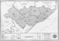
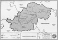
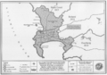
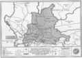
Schedule 1
| Map No. | Name of municipality and existing designation/code | Proposed designation/code | Minister's alternative proposal |
|---|---|---|---|
| Eastern Cape | |||
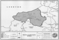
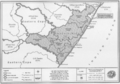
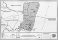
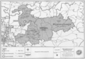
| 1 | Matatiele Local Municipality (KZ5a3) |
EC05b3 | The whole magisterial district of Maluti together with district management area, ECDMA44, and the small Matatiele area within Umzimvubu are to be excluded from Umzimvubu Local Municipality and incorporated into the Matatiele Local Municipality.
The remainder of Umzimvubu and the new Matatiele to constitute the Alfred Nzo District Municipality. |
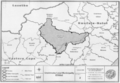
| 2 | Umzimvubu Local Municipality (EC05b2) |
EC05b2 | |
| 3 | Alfred Nzo District Municipality (DC44) |
DC44 | |
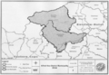
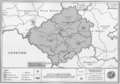
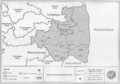
| 4 | West Rand District Municipality (CBDC8) |
DC48 | Merafong City Local Municipality is to be excluded from the municipal area of the West Rand District Municipality and included in the municipal area of the Southern District Municipality. Westonaria to remain in the West Rand District Municipality. |
| 5 | Southern District Municipality (DC40) |
DC40 | |
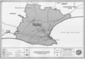
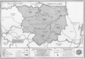
| District Management Area (GTDMA41) |
GTDMA48 | No changes to DMA boundary but designation/code to change. | |
| Westonaria Local Municipality (GT414) |
GT483 | No changes to municipal boundary but designation/municipal code to change. | |
| Merafong City Local Municipality (CBLC8) |
NW405 | No changes to municipal boundary but designation/municipal code to change. | |
| Mogale City Local Municipality (GT411) |
GT481 | No changes to municipal boundary but designation/municipal code to change. | |
| Randfontein Local Municipality (GT412) |
GT482 | No changes to municipal boundary but designation/municipal code to change. | |
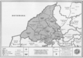
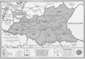
Schedule 2
The Province of the Eastern Cape
| Map No. | Notice No. |
|---|---|
| 6 | Map No. 38 of the Schedule to Notice 1179 of 2005 |
| 7 | Map No. 39 of the Schedule to Notice 1179 of 2005 |
| 8 | Map No. 40 of the Schedule to Notice 1179 of 2005 |
| 9 | Map No. 41 of the Schedule to Notice 1179 of 2005 |
| 10 | Map No. 42 of the Schedule to Notice 1179 of 2005 |
| 11 | Map No. 43 of the Schedule to Notice 1179 of 2005 |
The Province of Free State
| Map No. | Notice No. |
| 12 | Map No. 45 of the Schedule to Notice 1179 of 2005 |
| 13 | Map No. 46 of the Schedule to Notice 1179 of 2005 |
| 14 | Map No. 47 of the Schedule to Notice 1179 of 2005 |
| 15 | Map No. 48 of the Schedule to Notice 1179 of 2005 |
| 16 | Map No. 49 of the Schedule to Notice 1179 of 2005 |
The Province of Gauteng
| Map No. | Notice No. |
| 17 | Map No. 1 of the Schedule to Notice 1179 of 2005 |
| 18 | Map No. 2 of the Schedule to Notice 1179 of 2005 |
| 19 | Map No. 72 of the Schedule to Notice 1179 of 2005 |
| 20 | Map No. 73 of the Schedule to Notice 1179 of 2005 |
| 21 | Map No. 3 of the Schedule to Notice 3960 of 2005 (Gauteng Provincial Gazette No. 446 and Mpumalanga Gazette No. 1277) |
The Province of KwaZulu-Natal
| Map No. | Notice No. |
|---|---|
| 22 | Map No. 50 of the Schedule to Notice 1179 of 2005 |
| 23 | Map No. 51 of the Schedule to Notice 1179 of 2005 |
| 24 | Map No. 52 of the Schedule to Notice 1179 of 2005 |
| 25 | Map No. 53 of the Schedule to Notice 1179 of 2005 |
| 26 | Map No. 54 of the Schedule to Notice 1179 of 2005 |
| 27 | Map No. 55 of the Schedule to Notice 1179 of 2005 |
| 28 | Map No. 56 of the Schedule to Notice 1179 of 2005 |
| 29 | Map No. 57 of the Schedule to Notice 1179 of 2005 |
| 30 | Map No. 58 of the Schedule to Notice 1179 of 2005 |
| 31 | Map No. 59 of the Schedule to Notice 1179 of 2005 |
| 32 | Map No. 1 of the Schedule to Notice 1594 of 2005 |
The Province of Limpopo
| Map No. | Notice No. |
|---|---|
| 33 | Map No. 65 of the Schedule to Notice 1179 of 2005 |
| 34 | Map No. 66 of the Schedule to Notice 1179 of 2005 |
| 35 | Map No. 67 of the Schedule to Notice 1179 of 2005 |
| 36 | Map No. 15 of the Schedule to Notice 1594 of 2005 |
| 37 | Map No. 19 of the Schedule to Notice 1594 of 2005 |
The Province of Mpumalanga
| Map No. | Notice No. |
| 38 | Map No. 61 of the Schedule to Notice 1179 of 2005 |
| 39 | Map No. 2 of the Schedule to Notice 3960 of 2005 (Gauteng Provincial Gazette No. 446 and Mpumalanga Gazette No. 1277) |
| 40 | Map No. 23 of the Schedule to Notice 1594 of 2005 |
The Province of the Northern Cape
| Map No. | Notice No. |
|---|---|
| 41 | Map No. 35 of the Schedule to Notice 1179 of 2005 |
| 42 | Map No. 36 of the Schedule to Notice 1179 of 2005 |
| 43 | Map No. 37 of the Schedule to Notice 1179 of 2005 |
| 44 | Map No. 6 of the Schedule to Notice 1594 of 2005 |
| 45 | Map No. 11 of the Schedule to Notice 1594 of 2005 |
The Province of North West
| Map No. | Notice No. |
|---|---|
| 46 | Map No. 68 of the Schedule to Notice 1179 of 2005 |
| 47 | Map No. 69 of the Schedule to Notice 1179 of 2005 |
| 48 | Map No. 70 of the Schedule to Notice 1179 of 2005 |
The Province of the Western Cape
| Map No. | Notice No. |
|---|---|
| 49 | Map No. 29 of the Schedule to Notice 1179 of 2005 |
| 50 | Map No. 30 of the Schedule to Notice 1179 of 2005 |
| 51 | Map No. 31 of the Schedule to Notice 1179 of 2005 |
| 52 | Map No. 32 of the Schedule to Notice 1179 of 2005 |
| 53 | Map No. 33 of the Schedule to Notice 1179 of 2005 |
| 54 | Map No. 34 of the Schedule to Notice 1179 of 2005 |
-
 Map No. 1
 -
 Map No. 2
 -
 Map No. 3
 -
 Map No. 4
 -
 Map No. 5
 -
 Map No. 6
 -
 Map No. 7
 -
 Map No. 8
 -
 Map No. 9
 -
 Map No. 10
 -
 Map No. 11
 -
 Map No. 12
 -
 Map No. 13
 -
 Map No. 14
 -
 Map No. 15
 -
 Map No. 16
 -
 Map No. 17
 -
 Map No. 18
 -
 Map No. 19
 -
 Map No. 20
 -
 Map No. 21
 -
 Map No. 22
 -
 Map No. 23
 -
 Map No. 24
 -
 Map No. 25
 -
 Map No. 26
 -
 Map No. 27
 -
 Map No. 28
 -
 Map No. 29
 -
 Map No. 30
 -
 Map No. 31
 -
 Map No. 32
 -
 Map No. 33
 -
 Map No. 34
 -
 Map No. 35
 -
 Map No. 36
 -
 Map No. 37
 -
 Map No. 38
 -
 Map No. 39
 -
 Map No. 40
 -
 Map No. 41
 -
 Map No. 42
 -
 Map No. 43
 -
 Map No. 44
 -
 Map No. 45
 -
 Map No. 46
 -
 Map No. 47
 -
 Map No. 48
 -
 Map No. 49
 -
 Map No. 50
 -
 Map No. 51
 -
 Map No. 52
 -
 Map No. 53
 -
 Map No. 54


![]()
This work is in the public domain because it was created and first published in South Africa and it is an official text of a legislative, administrative or legal nature, or an official translation of such a text.
According to the Copyright Act, 1978, § 12 (8) (a), "No copyright shall subsist in official texts of a legislative, administrative or legal nature, or in official translations of such texts."
![]()
Public domainPublic domainfalsefalse