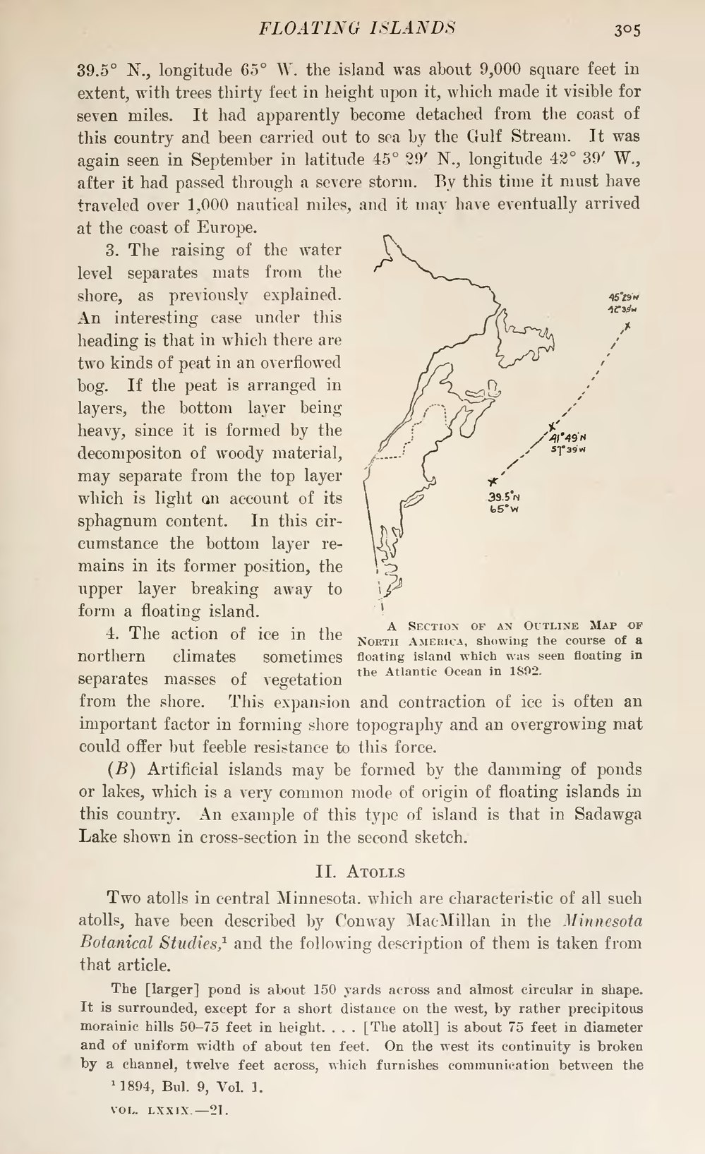
39.5° N., longitude 65° W. the island was about 9,000 square feet in extent, with trees thirty feet in height upon it, which made it visible for seven miles. It had apparently become detached from the coast of this country and been carried out to sea by the Gulf Stream. It was again seen in September in latitude 45° 29' N, longitude 42° 39' W., after it had passed through a severe storm. By this time it must have traveled over 1,000 nautical miles, and it may have eventually arrived at the coast of Europe.
 A Section of an Outline Map of North America, showing the course of a floating island which was seen floating in the Atlantic Ocean in 1892.
3. The raising of the water level separates mats from the shore, as previously explained. An interesting case under this heading is that in which there are two kinds of peat in an overflowed bog. If the peat is arranged in layers, the bottom layer being heavy, since it is formed by the decompositon of woody material, may separate from the top layer which is light on account of its sphagnum content. In this circumstance the bottom layer remains in its former position, the upper layer breaking away to form a floating island.
4. The action of ice in the northern climates sometimes separates masses of vegetation from the shore. This expansion and contraction of ice is often an important factor in forming shore topography and an overgrowing mat could offer but feeble resistance to this force.
(B) Artificial islands may be formed by the damming of ponds or lakes, which is a very common mode of origin of floating islands in this country. An example of this type of island is that in Sadawga Lake shown in cross-section in the second sketch.
II. Atolls
Two atolls in central Minnesota, which are characteristic of all such atolls, have been described by Conway MacMillan in the Minnesota Botanical Studies,[1] and the following description of them is taken from that article.
- ↑ 1894, Bul. 9, Vol. 1.